
Most Popular


-
6
Actor’s excessive airport security sparks probe into human rights violations

-
7
Actor Yoo Ah-in accused of sexual attack

-
8
Man who let his father die due to financial difficulties to be released on parole

-
9
S. Korea, China shifting from tensions to cooperation: Seoul

-
10
LG Electronics achieves record earnings in Q2


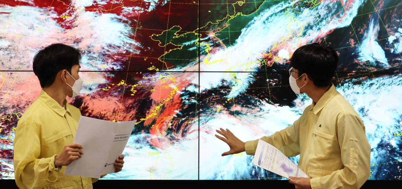
Typhoon Hinnamnor is approaching South Korea, and it is expected to bring heavy rains accompanied by strong winds to the southern part of the country, including the island of Jeju, the state weather agency said Friday.
According to the Korea Meteorological Administration, Typhoon Hinnamnor, the 11th typhoon of this year, is currently passing Taiwan's east coast and began to move northward at a slow speed, 2 kilometers per hour.
Typhoon Hinnamnor is expected to pick up speed Saturday night to hit the island of Jeju on Monday morning and arrive at the southern coast of the Korean Peninsula by Tuesday morning. The typhoon is anticipated to pass the southern coast of Busan and move to the east coast.
The typhoon, however, can change its path in response to a system of high atmospheric pressure in the North Pacific. The state weather agency said the typhoon’s trajectory will become clearer during Saturday and Sunday.
“It is currently difficult to pinpoint which part of the southern coast of the Korean Peninsula will be directly hit by the typhoon,” said weather analyst Woo Jin-kyu from the country's weather agency. Woo added the typhoon can potentially hit the southern coast of South Jeolla Province if the typhoon changes its path on its way here.
Typhoon Hinnamnor has been recently weakened, but still a very strong storm with an atmospheric pressure of 935 hectopascals and a maximum wind speed of 49 meters per second.
By the time it arrives in South Korea, Typhoon Hinnamnor is expected to weaken further. According to the weather agency, the typhoon’s atmospheric pressure will reach 950, with a maximum wind speed of 43 mps when it hits the country.
The lower the typhoon’s atmospheric pressure falls, the faster the wind speeds become, making the typhoon stronger and more dangerous.
Although it becomes slightly weaker, Typhoon Hinnamnor is expected to be as strong as Typhoon Sarah in 1995 and Typhoon Maemi in 2003 – the strongest typhoons that devastated the country in its recent history – according to the weather agency.
“(The country) has not seen a typhoon with such low pressure arriving here yet. The weather agency is concerned about unprecedented damages that can be brought by the typhoon,” Woo said.
As the typhoon approaches South Korea, the southeastern part of Jeju is expecting precipitation ranging between 100 and 350 millimeters between Friday and Sunday. The southern coasts of South Jeolla Province and South Gyeongsang Province expect 50-150 millimeters of rain during the same period.
The weather agency said the whole country will be under the influence of Typhoon Hinnamnor from Sunday through Wednesday next week.
Starting Monday night, the typhoon will increase the sea level and bring strong winds, which can cause floods and landslides in some areas. The weather agency demanded local governments and citizens prepare for possible damages to facilities and casualties.


![[Today’s K-pop] Treasure to publish magazine for debut anniversary](http://res.heraldm.com/phpwas/restmb_idxmake.php?idx=642&simg=/content/image/2024/07/26/20240726050551_0.jpg&u=)