Most Popular
-
1
Tensions heighten ahead of first president-opposition chief meeting

-
2
Seoul to provide housing subsidy to married couples with newborns

-
3
New celebrity-endorsed therapy for face contouring requires only a pair of rubber bands

-
4
Rapper jailed after public street fight with another rapper

-
5
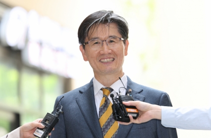
[KH Explains] No more 'Michael' at Kakao Games
![[KH Explains] No more 'Michael' at Kakao Games](//res.heraldm.com/phpwas/restmb_idxmake.php?idx=644&simg=/content/image/2024/04/28/20240428050183_0.jpg&u=20240428180321)


![[KH Explains] No more 'Michael' at Kakao Games](http://res.heraldm.com/phpwas/restmb_idxmake.php?idx=644&simg=/content/image/2024/04/28/20240428050183_0.jpg&u=20240428180321)
-
6
Nominee for chief of anti-corruption body pledges 'independence, effectiveness'
-
7
Woman gets suspended term for injuring boyfriend with knife

-
8
Med schools expect 1,500+ new admission slots next year
-
9
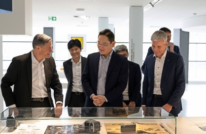
Samsung chief bolsters ties with Germany’s Zeiss
-
10
KT launches new mobile plans for foreign residents


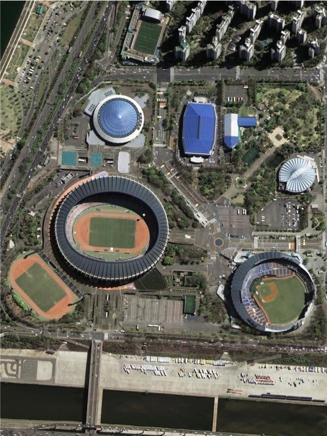
Transport ministry shares next-generation medium-sized satellite’s recordings of landmarks in Korea
CAS500 marks South Korea’s first all-Korean mid-sized practical satellite
By Yim Hyun-suPublished : May 10, 2021 - 14:47
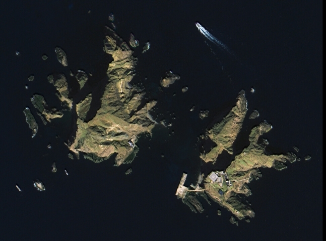
The Ministry of Land, Infrastructure and Transport has unveiled satellite recordings of some of South Korea’s landmarks captured by the country’s next-generation medium-sized satellite, including the Government Complex in Sejong, Seoul Olympic Stadium and the easternmost islets of Dokdo.
The satellite, Compact Advanced Satellite 500 or CAS500, was launched from the Baikonur Cosmodome in Kazakhstan on March 22, becoming the country’s first national land observation satellite.
Boasting 50cm spatial resolution, one image presents a detailed view of a helipad located in the eastern side of Dokdo alongside a ship cruising along its sea, the ministry explained.
Some of the satellite images captured by CAS500 include Ferrari World Abu Dhabi in the United Arab Emirates and The Taj Mahal in India.
The satellite is currently under a trial operation with calibration and validation activity. After the process is finalized, the image is set to further improve in radiometric and geometric accuracy.
Though the specification of the new satellite has similarities to other mid-sized practical satellites that South Korea has previously launched, the CAS500 is the first satellite developed by the country’s own technologies, according to the ministry.
Over 98 percent of the technologies and components, including the optical payload, were developed within the country, it said, with the exception of the charge-coupled device.
The observation satellite, which was developed by the Korea Aerospace Research Institute with funding from the science and transport ministries, is also the 17th satellite Korea has launched to the space.
Korea has deployed eight small satellites, five KOMPSAT satellites dubbed Arirang, and three GEO-KOMPSAT satellites known as Cheollian since the KITSAT-1 (Our Star) in 1992.
The national land observation satellite was launched to scan the Korean peninsula from 497.8 kilometers above the surface, passing the location at 11 am local time during its daily orbit of the Earth.
It will also be used for inspection of the national territory, survey of crop cultivation in farms, as well as gathering of raw data for map making and urban planning.
It is expected to also boost the country‘s capacity for disaster response by providing an exclusive data source on natural disasters such as storms, heavy snow, floods, and wildfires.
The satellite will also provide data for the digital twin platform and smart city -- two key areas in the current administration’s New Deal Program as well as contributing to advanced transportation, including autonomous vehicles and drones.
By Yim Hyun-su (hyunsu@heraldcorp.com)


![[Herald Interview] Mistakes turn into blessings in street performance, director says](http://res.heraldm.com/phpwas/restmb_idxmake.php?idx=652&simg=/content/image/2024/04/28/20240428050150_0.jpg&u=20240428174656)