

Most Popular
-
1
1 in 3 Koreans live alone, family types becoming diverse

-
2
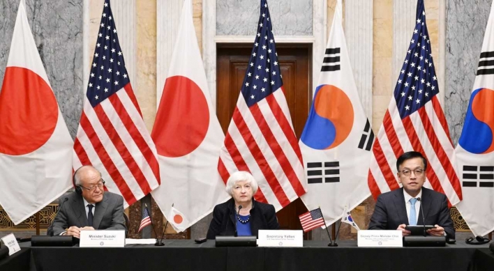
Korea, Japan finance chiefs vow to tame rampant FX market volatility

-
3
US 'incredibly concerned' about suspected NK-Iran military ties
-
4
K-pop group's manager dismissed for setting up spycam in theater dressing room

-
5
K-pop singer lost consciousness after being hit by foul ball, cancels show


![[Kim Seong-kon] Democracy and the future of South Korea](http://res.heraldm.com/phpwas/restmb_idxmake.php?idx=644&simg=/content/image/2024/04/16/20240416050802_0.jpg&u=)


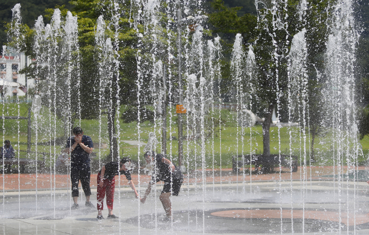
With heat wave warnings issued nationwide Tuesday, Korea is likely to see temperatures near 40 degrees Celsius this week, and possibly a return of the record-breaking heat in 2018 due to a “heat dome” phenomenon, the chief of a nongovernmental weather agency said.
“Korea saw the hottest day ever recorded on Aug. 1, 2018, when temperatures hit 39.6 degrees in Seoul and 41 degrees in Hongcheon, Gangwon Province. These were official observatory records, and automatic weather station (AWS) records showed some places had temperatures two to three degrees higher,” Ban Ki-seong, chief of K Weather said in a radio interview Tuesday morning.
“From this week, the North Pacific high pressure moves north, and pushes up the monsoon front. This is why it’s so hot today. In Seoul, we expect 33 degrees today, 35 degrees tomorrow, 37 degrees on Thursday, and 37 to 38 degrees on Friday. This means it could go up to 40 degrees on AWS in certain regions such as the western Gangwon Province, eastern Gyeonggi Province.”
It is hard to forecast now what it will be like in August, Ban said, as typhoons can affect the weather, but he expects periods of scorching heat once or twice in the month.
Ban said the record high temperatures in the summer of 2018 were also caused by a heat dome phenomenon, when vast areas of sweltering heat get trapped under a high-pressure dome.
In recent years, Korea has increasingly seen tropical summers, with scorching heat followed by sudden, short rain showers similar to what is common in Southeast Asia.
“Korea’s southern coastal regions and Jeju Island are subtropical regions, and the midland areas have not been categorized as subtropical because they have cold winters, but their summers are subtropical. Temperatures here are higher than Southeast Asia,” Ban said.
“We are in the center (of the North Pacific High) this week, so we won’t have sudden showers, but if we do have rain showers due to the influence of the North Pacific High in early August, obviously we will see Southeast Asia-like squalls.”
The Korea Meteorological Administration said Tuesday the seasonal monsoon period had ended, and full-scale sweltering heat will take over.
From Wednesday, daytime highs will rise by up to 3 degrees to above 35 degrees in many parts of the country, while temperatures will feel higher by at least 1 degree due to high humidity, according to the KMA.
The North Pacific High and the Tibetan High, both containing hot air, are forecast to meet over the Korean Peninsula, creating a heat dome in which areas of high pressure stay and act like a pressure cooker lid that traps hot air.
The heat waves that have baked the country for the past three weeks will only worsen and could continue for another month until around Aug. 20 if typhoons don’t affect the weather, Ban said.
Kim Baek-min, a professor of atmospheric science at Pukyong National University, said it was possible that the heat dome caused by the Tibetan High could raise temperatures to record levels over 40 degrees.
Tropical nights, which is when the temperature does not fall under 25 degrees from 6 p.m. through 9 a.m. the next day, will continue as well, Kim said.
The KMA forecast daytime highs to reach 34 degrees on Tuesday in Seoul, Suwon, Chuncheon, Cheongju, Daejeon, Jeonju and Daegu; 33 degrees in Incheon, Wonju, Gwangju and Changwon; 32 degrees in Mokpo, Busan, Ulsan and Namhae; 31 degrees in Gangneung and Jeju.
Sensible temperature, or what people actually feel, would rise to 35 degrees, the KMA said.

![[KH Explains] Hyundai's full hybrid edge to pay off amid slow transition to pure EVs](http://res.heraldm.com/phpwas/restmb_idxmake.php?idx=652&simg=/content/image/2024/04/18/20240418050645_0.jpg&u=20240418181020)
![[Today’s K-pop] Zico drops snippet of collaboration with Jennie](http://res.heraldm.com/phpwas/restmb_idxmake.php?idx=642&simg=/content/image/2024/04/18/20240418050702_0.jpg&u=)