
South Korea has found a 17th century nautical chart made by a British explorer marking the expanse of water between Korea and Japan as the Sea of Korea.
The chart drawn by Sir Robert Dudley in 1646 was revealed just a week ahead of a general assembly meeting of the International Hydrographic Organization scheduled for April 23 through 27 in Monaco, which may possibly change the name of the waters currently named the Sea of Japan.
South Korea wants the IHO to concurrently call the waters the East Sea, as it is known to Koreans, and the Sea of Japan, saying the original Sea of Korea name was changed after Japan colonized Korea in the early 19th century. Korea was a Japanese colony from 1910 to 1945.
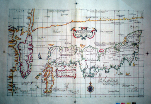
A 17th century nautical chart made by Robert Dudley (Yonhap News)
Japan registered the name Sea of Japan with the IHO in the early 1920s.
It is the first time a 17th century map has shown the waters separating the countries as the Sea of Korea, although similar maps from later periods exist.
“It is the first kind of map made in the 17th century, although we have several maps made in the 18th and 19th centuries,” said emeritus professor Kim Mun-gil of the Busan University of Foreign Studies. “The Japanese in charge of the chart at the cultural center have acknowledged that Japan began using the name, Sea of Japan, only in the 19th century.”
Kim said he found the chart at a Japanese cultural center affiliated with the Japanese Education Ministry.
The chart describes the waters lying between Korea and Japan as “Mare di Corai” while depicting waters south of the southern Japanese island of Kagoshima as “Mare di Giappone.”
(Yonhap News)
koreaherald@heraldcorp.com