Most Popular
-
1
Ador CEO denies allegations, accuses Hybe of mistreating NewJeans

-
2
Medical reform committee kicks off despite boycott from doctors

-
3
10-man S. Korea lose to Indonesia to miss out on Paris Olympic football qualification

-
4
Hybe-Ador feud should have limited effect on Hybe's overall performance: analysts

-
5
DP leader says he will meet Yoon without conditions


-
6
Second Gimpo civil servant found dead, after apologizing for not finishing work
-
7
Over 9,000 hotline calls made by stalking victims in 2023

-
8
[Hello India] Hyundai Motor vows to boost 'clean mobility' in India
![[Hello India] Hyundai Motor vows to boost 'clean mobility' in India](//res.heraldm.com/phpwas/restmb_idxmake.php?idx=644&simg=/content/image/2024/04/25/20240425050672_0.jpg&u=)
-
9
Monthly users on local streaming platforms outpace Netflix, Disney+

-
10
US will take steps for three-way engagement on nuclear deterrence with S. Korea, Japan: Campbell


![[Hello India] Hyundai Motor vows to boost 'clean mobility' in India](http://res.heraldm.com/phpwas/restmb_idxmake.php?idx=644&simg=/content/image/2024/04/25/20240425050672_0.jpg&u=)


New historical map marking Dokdo as Korean territory found in Japan
By Catherine ChungPublished : Aug. 2, 2017 - 11:18
Nam Kwon-hee, a professor at Kyungpook National University, said he confirmed the existence of what appeared to be Dokdo on the right side of Ulleung Island in the East Sea on the colored, handwritten version of Daedongyeojido, a Korean map made by cartographer and geologist Kim Jeong-ho in 1861.
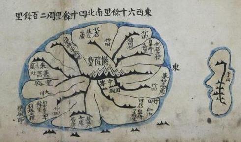
The discovery came amid Japan's repeated sovereignty claims to South Korea's easternmost islets.
The manuscript owned by a Japanese national is estimated to have been created between 1864 and 1889, Nam said.
It used to belong to a library in Pyongyang, North Korea, and it is unknown how it was brought to Japan, Nam added. Inside the map remained the library's serial number and the date it was obtained -- Aug. 30, 1932.
The discovery resulted from cooperation among Nam, Yukio Fujimoto, honorary professor at University of Toyama, and professor Kim Seong-su from Cheongju University in North Chungcheong Province.
The National Diet Library of Japan is believed to possess one copy of the handwritten Daedongyeojido with Dokdo on it and the Research Institute for Korean Studies has another copy, the registered cultural property No. 638.
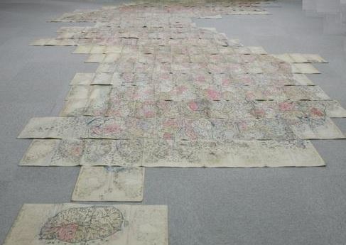
The handwritten Daedongyeojido is an improvement of cartographer Kim's orginal woodprint version, which didn't include Dokdo.
"On a colored (Korean) map that Kim Jeong-ho completed in 1834, Dokdo was marked on the right side of Ulleungdo, but on Daedongyeojido created later than this didn't have Dokdo on it," Nam said. "We think Kim added Dokdo to Daedongyeojido when producing the handwritten version."
The newly found map also contains an additional 2,000 pieces of geographical, architectural and historic data absent from the woodprint version. (Yonhap)