

Most Popular
-
1
[AtoZ into Korean mind] Humor in Korea: Navigating the line between what's funny and not
![[AtoZ into Korean mind] Humor in Korea: Navigating the line between what's funny and not](//res.heraldm.com/phpwas/restmb_idxmake.php?idx=644&simg=/content/image/2024/04/22/20240422050642_0.jpg&u=)
-
2
Yoon seeks rebound, taps 5-term lawmaker as chief of staff

-
3
[Exclusive] Korean military set to ban iPhones over 'security' concerns
![[Exclusive] Korean military set to ban iPhones over 'security' concerns](//res.heraldm.com/phpwas/restmb_idxmake.php?idx=644&simg=/content/image/2024/04/23/20240423050599_0.jpg&u=20240423183955)
-
4
Medical standoff deepens as doctors reject new med school plan, talks

-
5
[Herald Interview] Why Toss invited hackers to penetrate its system
![[Herald Interview] Why Toss invited hackers to penetrate its system](//res.heraldm.com/phpwas/restmb_idxmake.php?idx=644&simg=/content/image/2024/04/22/20240422050569_0.jpg&u=20240422150649)
![[AtoZ into Korean mind] Humor in Korea: Navigating the line between what's funny and not](http://res.heraldm.com/phpwas/restmb_idxmake.php?idx=644&simg=/content/image/2024/04/22/20240422050642_0.jpg&u=)

![[Exclusive] Korean military set to ban iPhones over 'security' concerns](http://res.heraldm.com/phpwas/restmb_idxmake.php?idx=644&simg=/content/image/2024/04/23/20240423050599_0.jpg&u=20240423183955)

![[Herald Interview] Why Toss invited hackers to penetrate its system](http://res.heraldm.com/phpwas/restmb_idxmake.php?idx=644&simg=/content/image/2024/04/22/20240422050569_0.jpg&u=20240422150649)
-
6
[Graphic News] 77% of young Koreans still financially dependent
![[Graphic News] 77% of young Koreans still financially dependent](//res.heraldm.com/phpwas/restmb_idxmake.php?idx=644&simg=/content/image/2024/04/22/20240422050762_0.gif&u=)
-
7
Korean, Romanian leaders discuss defense tech, nuclear energy

-
8
S. Korean envoys convene to navigate strategy amid Middle East tensions

-
9
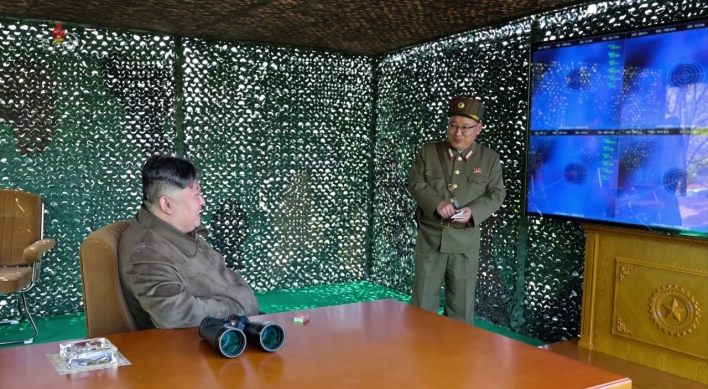
North Korea fires several short-range ballistic missiles into sea: JCS

-
10
Samsung, SK hynix investors dump shares on Nvidia crash

![[Graphic News] 77% of young Koreans still financially dependent](http://res.heraldm.com/phpwas/restmb_idxmake.php?idx=644&simg=/content/image/2024/04/22/20240422050762_0.gif&u=)


SIOUX FALLS, South Dakota (AP) ― A fleet of picture-snapping NASA satellites that for 40 years has documented forest fires, tsunamis and everyday changes in the Earth’s geography will soon get a new member.
With Landsat 8 set for a February launch, nearly 140 scientists and engineers from more than 25 countries are scheduled to gather in South Dakota next week to discuss how to best download, process and distribute the millions of data-rich images used in agriculture, education, business and government.
Since 1972, Landsat satellites have been continuously snapping pictures across the globe as part of a 40-year mission to document the planet.
But with Landsat 7 aging and its older sibling Landsat 5 failing, a new orbiter is needed to continue the long-term data record, said Jenn Sabers, remote sensing branch chief at the U.S. Geological Survey Center for Earth Resources Observations and Science.

“One of the things we want to do is preserve that legacy by ensuring that we collect consistent data with the prior missions,” Sabers said. “Although we have that consistency, we also want to make improvements.”
The USGS Center for EROS, located in the middle of farmland north of Sioux Falls, is the main federal repository for satellite images. Officials wanted to locate the center in the middle of the U.S, and they chose South Dakota in 1970 over several other states, partly due to persistent campaigning by the late Sen. Karl Mundt.
Members of the Landsat Technical Working Group will gather at the center next week to discuss how to best use the data-packed photos from the new orbiter, which will be known as Landsat 8 once it reaches space. The team, which provides scientific and technical input to the U.S. Geological Survey and NASA, will plan how to establish reception, processing and distribution capabilities from the new satellite.
Landsat satellites help document calamities, such as forest fires and hurricanes, as well as mapping the world’s mangrove forests and tracking ice in the Antarctic. The images differ from programs such as Google Earth, as you can’t see individual homes, but are able to see larger things, such as highways, NASA says.
Sabers said Landsat 8 will work harder, capturing at least 400 scenes a day instead of 250. It will also be able to point at angles not directly below the satellite, which can greatly assist gathering data during a disaster, she said.
“Before where the satellite would see exactly below it in the track, we can actually point the collection as well,” Sabers said. “So we can get something next to where we would normally be collecting.”
Jim Irons, NASA’s Landsat Data Continuity Mission project scientist, said Landsat 8’s sensor will offer improved sensitivity and a higher signal-to-noise ratio for more accurate land cover maps. The new technology is like switching from a ruler marked every quarter of an inch to one marked every 1/64th or 1/128th of an inch, he said.
Landsat 8 will also allow scientists to read ocean chlorophyll in coastal regions, detect cirrus clouds and correct for atmospheric effects.
NASA launched the first Landsat satellite in 1972, and the orbiters have been sending images back to EROS ever since. Two are still orbiting the Earth.
-
Articles by Korea Herald


![[Exclusive] Korean military to ban iPhones over security issues](http://res.heraldm.com/phpwas/restmb_idxmake.php?idx=652&simg=/content/image/2024/04/23/20240423050599_0.jpg&u=20240423183955)


![[Today’s K-pop] Ateez confirms US tour details](http://res.heraldm.com/phpwas/restmb_idxmake.php?idx=642&simg=/content/image/2024/04/23/20240423050700_0.jpg&u=)