

Most Popular


-
6
[Graphic News] More Koreans say they plan long-distance trips this year
![[Graphic News] More Koreans say they plan long-distance trips this year](//res.heraldm.com/phpwas/restmb_idxmake.php?idx=644&simg=/content/image/2024/04/17/20240417050828_0.gif&u=)
-
7
[KH Explains] Hyundai's full hybrid edge to pay off amid slow transition to pure EVs
![[KH Explains] Hyundai's full hybrid edge to pay off amid slow transition to pure EVs](//res.heraldm.com/phpwas/restmb_idxmake.php?idx=644&simg=/content/image/2024/04/18/20240418050645_0.jpg&u=20240419100350)
-
8
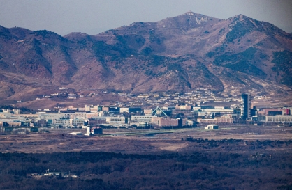
North Korea removes streetlights along cross-border roads with South
-
9
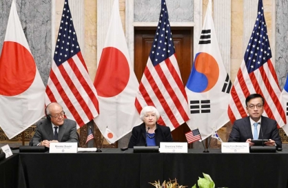
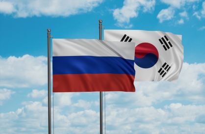
Russia's denial of entry of S. Korean national unrelated to bilateral ties: Seoul official
-
10
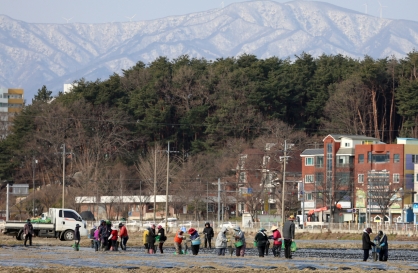
Farming households dip below 1m for first time in 2023
![[Graphic News] More Koreans say they plan long-distance trips this year](http://res.heraldm.com/phpwas/restmb_idxmake.php?idx=644&simg=/content/image/2024/04/17/20240417050828_0.gif&u=)
![[KH Explains] Hyundai's full hybrid edge to pay off amid slow transition to pure EVs](http://res.heraldm.com/phpwas/restmb_idxmake.php?idx=644&simg=/content/image/2024/04/18/20240418050645_0.jpg&u=20240419100350)


Korea finds 17th century marine chart depicting Sea of Korea
By 윤민식Published : April 15, 2012 - 13:10
South Korea has found a 17th century nautical chart made by a British explorer marking the expanse of water between Korea and Japan as the Sea of Korea.
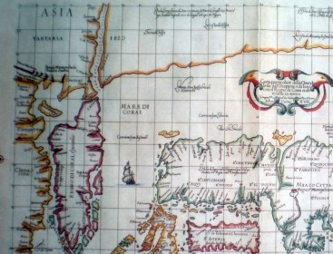
The chart drawn by Sir Robert Dudley in 1646 was revealed just a week ahead of a general assembly meeting of the International Hydrographic Organization (IHO) scheduled for April 23 through 27 in Monaco, which may possibly change the name of the waters currently named as the Sea of Japan.
South Korea wants the IHO to concurrently call the waters the East Sea, as it is known to Koreans, and the Sea of Japan, saying the original Sea of Korea name was changed after Japan colonized Korea in the early 19th century. Korea was a Japanese colony from 1910 to 1945.
Japan registered the name Sea of Japan with the IHO in the early 1920s.
It is the first time a 17th century map has shown the waters separating the countries as the Sea of Korea, although similar maps from later periods exist.
"It is the first kind of map made in the 17th century, although we have several maps made in the 18th and 19th centuries," said emeritus professor Kim Mun-gil of the Busan University of Foreign Studies. "The Japanese in charge of the chart at the cultural center have acknowledged that Japan began using the name, Sea of Japan, only in the 19th century."
Kim said he found the chart at a Japanese cultural center affiliated with the Japanese Education Ministry.
The chart describes the waters lying between Korea and Japan as "Mare di Corai" while depicting waters south of the southern Japanese island of Kagoshima as "Mare di Giappone." (Yonhap News)
<관련 한글 기사>
동해 '한국해'로 표기한 17세기 지도 발견
"17세기 것은 처음…당시 일본인 인식 반영"
현재의 동해 해역을 '한국해'로 표기한 17세기 중반 고지도의 사본이 일본에서 발견됐다.
동해의 국제 명칭을 결정할 오는 23일 모나코 국제수로기구(IHO) 총회를 앞두고 이 고지도는 '일본해'를 고집하는 일본 측 주장의 설득력이 떨어짐을 보여주는 좋은 증거라 할 수 있다.
한일문제 전문가인 김문길(부산외국어대 명예교수) 한일문화연구소장은 15일 로버트 더들리(Sir Robert Dudley)가 1646년에 그린 고지도에 일본이 '일본해'라고 주장하는 바다가 'Mare di Corai', 즉 '한국해'로 나와 있다"고 밝혔다.
로버트 더들리는 17세기 엘리자베스 1세 때 영국의 귀족이자 이탈리아에서 활동 한 탐험가 겸 지도 제작자로, 최초의 세계 해도(海圖)인 '바다의 신비'(Dell'Arcano del Mare)를 제작한 인물이다.
이 지도는 '바다의 신비'의 '아시아 해도 17장'(Asia Carta ⅩⅦ)으로 일본과 한반도 해안선을 비롯해 '한국해'와 '일본해'(Mare di Giappone) 등을 표시하고 있다.
지도에는 현재의 동해 해역이 '한국해'로 표시돼 있고 일본 가고시마 남단 해역 이 '일본해'로 표기돼 있다.
김 소장은 "폐쇄된 17세기 조선에 비해 개방적이었던 일본인들로부터 해도 작성 에 필요한 정보가 나왔을 것"이라며 "이 지도에 나타난 한국해와 일본해라는 명칭은 당시 일본인들의 인식을 반영한다"고 설명했다.
이 지도는 일본 문부성 산하 국제일본문화센터 소장품으로 일본 학계의 검증도 거친 것으로 볼 수 있다고 그는 전했다.
김 소장은 "지금까지 19세기, 18세기 고지도를 발견한 바 있지만 17세기 지도는 처음 확인한 것"이라며 "방위 개념에 따른 '동해' 명칭보다는 이 지도대로 '한국해'로 하는 것이 더 타당하고 설득력 있다"고 밝혔다.
그는 "이 지도를 담당하는 일본인 관계자도 '19세기 이후에야 일본해 명칭이 등 장하기 시작한다'고 했다"며 "일본 제국주의 이데올로기가 일본해라는 명칭을 만들어낸 것"이라고 말했다. (연합뉴스)

![[From the Scene] Monks, Buddhists hail return of remains of Buddhas](http://res.heraldm.com/phpwas/restmb_idxmake.php?idx=652&simg=/content/image/2024/04/19/20240419050617_0.jpg&u=20240419175937)

![[KH Explains] Hyundai's full hybrid edge to pay off amid slow transition to pure EVs](http://res.heraldm.com/phpwas/restmb_idxmake.php?idx=652&simg=/content/image/2024/04/18/20240418050645_0.jpg&u=20240419100350)

![[Today’s K-pop] Illit drops debut single remix](http://res.heraldm.com/phpwas/restmb_idxmake.php?idx=642&simg=/content/image/2024/04/19/20240419050612_0.jpg&u=)