Most Popular
-
1
1 in 3 Koreans live alone, family types becoming diverse

-
2
Korea, Japan finance chiefs vow to tame rampant FX market volatility

-
3
K-pop group's manager dismissed for setting up spycam in theater dressing room

-
4
Contentious grain bill put directly to plenary meeting for vote

-
5
Why is Apple Pay struggling to get purchase in Korea?


-
6
Will tug-of-war between doctors, government end soon?

-
7
Trilateral talks acknowledge ‘serious’ slumps of won, yen

-
8
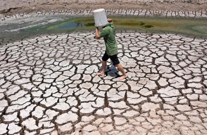
Climate impacts set to cut 2050 global GDP by nearly a fifth
-
9
[Today’s K-pop] BTS pop-up event to come to Seoul
![[Today’s K-pop] BTS pop-up event to come to Seoul](//res.heraldm.com/phpwas/restmb_idxmake.php?idx=644&simg=/content/image/2024/04/17/20240417050734_0.jpg&u=)
-
10
[Graphic News] More Koreans say they plan long-distance trips this year
![[Graphic News] More Koreans say they plan long-distance trips this year](//res.heraldm.com/phpwas/restmb_idxmake.php?idx=644&simg=/content/image/2024/04/17/20240417050828_0.gif&u=)


![[Today’s K-pop] BTS pop-up event to come to Seoul](http://res.heraldm.com/phpwas/restmb_idxmake.php?idx=644&simg=/content/image/2024/04/17/20240417050734_0.jpg&u=)
![[Graphic News] More Koreans say they plan long-distance trips this year](http://res.heraldm.com/phpwas/restmb_idxmake.php?idx=644&simg=/content/image/2024/04/17/20240417050828_0.gif&u=)

For more than half a century, geologists have wrangled over the origins of an astonishing range of mountains found beneath ice up to three kilometers (two miles) thick in East Antarctica.
Named after the Soviet geophysicist who detected them in 1958 during the first International Polar Year exploration, the Gamburtsev mountains are 1,200 kilometers (750 miles) long, with jagged peaks up to 2,700 meters (8,900 feet) high intersected by deep troughs and valleys.
How this chain came into being is one of the many mysteries of the great white continent.
The Gamburtsevs are located at high elevation and on a continent that geologically is ancient and long free of the tectonic upheaval that throws up mountains.
Yet their sharp edges, like Europe's Alps, clearly attest to a youthful range barely touched by the erosive forces of wind, snow and water.
An international team of scientists, reporting in the journal Nature on Wednesday, say they have the answer to the riddle.
The key, they believe, lies in a network of lakes and rifts in the bedrock, remarkably mirroring features found in the parched African tropics half a world away.
"The East Antarctic rift system resembles one of the geological wonders of the world, the East African rift system," said head investigator Fausto Ferraccioli of the British Antarctic Survey (BAS).
"It provides the missing piece of the puzzle that helps explain the Gamburtsev Subglacial Mountains. The rift system was also found to contain the largest subglacial lakes in Antarctica."
The rift network was found thanks to a second exploration of the Gamburtsevs, carried out in the last International Polar Year, which despite its name ran from 2007-2009 in order to cover the seasons at both poles.
The seven-nation project mapped the subglacial topography in central East Antarctica using two Twin Otter aircraft fitted with penetrating radar and sensors to map changes in Earth's gravitational and magnetic field.
What they propose is a narrative starting a billion years ago.
Several mini-continents collided together to form a super-continent called Gondwana, creating a mountain range at the point of impact.
Eventually, the uplifted rock collapsed under its own weight and over aeons eroded away, leaving an underlying crustal "root."
There next followed two periods of rifting, some 250 million years ago and again about 100 million years ago, in which Gondwana pulled part in tectonic agony.
This created a 3,000-km (2,000-mile) fracture in the planet's crust that extends from East Antarctica across the ocean to India.
The residual "root," combined with the rifting, helped force up the land that is now East Antarctica.
In doing so, this developed an extensive rift-valley system, whose flanks were incised by rivers -- and then by glaciers, as Earth moved from warmth into deepening chill.
Some 34 million years ago, the magnificent mountains became smothered by the East Antarctic icesheet, an area the size of Canada. Like Sleeping Beauty, they retained their eerie youthfulness.
Piecing together the story of the Gamburtsevs as a tale of mountain rejuvenation was an exercise in humility, said Carol Finn of the US Geological Survey (USGS).
"We are accustomed to thinking that mountain-building relates to a single tectonic event rather than sequences of events," she said.
"The lesson we learned about multiple events forming the Gamburtsevs may inform studies of the history of other mountain belts."
<한글 기사>
남극 빙상 밑 `유령산맥' 기원 밝혀져
남극 대륙의 두꺼운 빙상 밑에 숨어 있는 `유령산맥' 감부르체 프 산맥이 어떻게 형성됐는지, 지난 3천만년 동안 빙하의 흐름에 어떤 역할을 했는 지 등이 처음으로 밝혀졌다고 사이언스 데일리와 BBC 뉴스가 17일 보도했다.
남극 대륙 감부르체프주(AGAP) 프로젝트에 참여한 국제 연구진은 지난 2008~200 9년 사이 빙상 투과 레이더와 중력 및 자기장 측정기 등 다양한 첨단 장비를 장착한 항공기로 대륙 상공을 누비면서 빙상 밑 지형을 조사했으며 이후 방대한 자료를 분 석, 종합한 결과를 네이처지 최신호에 발표했다.
연구진이 밝힌 감부르체프 산맥의 역사는 이렇다.
"약 10억년 전 지구의 여러 대륙이 충돌해 감부르체프 산맥을 융기시키면서 산 맥 밑바닥에 두껍고 밀도가 높은 암석 `뿌리'를 깔아놓았다. 이후 오랜 시간이 지나 면서 산맥은 침식을 겪었지만 산맥의 차가운 뿌리는 그대로 남았다.
2억5천만~1억년 전 공룡시대에는 남극대륙을 포함한 초대륙 곤드와나가 산맥의 뿌리 인접부에서 갈라져 나가면서 뿌리의 온도를 높였다. 그 결과 다시 활동하기 시 작한 뿌리와 남극대륙 동부 지구대(地溝帶)는 육지를 다시 들어 올려 산맥의 형태를 바꿔놓았다.
이어 강과 빙하가 계곡을 깊게 파고 여러 봉우리를 들어 올려 마치 유럽의 알프 스와 같은 웅장한 풍경을 만들었다. 약 3천400만년 전 빙하의 흐름으로 형성된 1천
만㎢의 남극 동부 빙상이 캐나다와 맞먹는 면적을 덮어 지금까지 감부르체프 산맥을 침식으로부터 보호해 왔다."
연구진은 감부르체프 산맥의 역사가 10억년에 가까운 것으로 나타났다면서 자신 들의 연구는 이처럼 오래된 산맥도 불사조처럼 다시 솟아오를 수 있음을 보여주는 것이라고 강조했다. 감부르체프는 오랫동안 침식돼 온 남극대륙 동부 강괴(剛塊: 캄 브리아기 이후 지각변동을 겪지 않은 매우 안정된 대륙 지각)로부터 솟아올랐다는 것이다.
이 연구는 또 언뜻 보기에 모순되는 현상도 설명해 주고 있다. 즉 이처럼 오래 된 산맥이 어떻게 그처럼 높고 날카로운 유년기 형태의 봉우리들을 그대로 갖고 있 을 수 있는가 하는 것이다.
연구진은 이에 대해 "우리는 산맥들이 단 한 차례의 판운동 사건에 의해 형성됐 을 것으로 믿는데 익숙해져 있지만 감부르체프에서 우리가 배운 것은 여러 차례의 사건이 기여했다는 것이며 이는 다른 산맥의 역사에도 참고 자료가 될 것"이라고 말 했다.
이들은 또 남극 대륙 동부 지구대가 동아프리카 지구대와 비슷하다는 놀라운 사 실을 발견했다면서 이는 감부르체프 산맥 형성 과정의 알려지지 않은 부분을 말해줄 것이라고 밝혔다.
이 연구에서는 또 남극대륙 동부 지구대에 남극 대륙 최대의 빙상 밑 호수가 있 는 것으로 나타났다. 연구진의 다음 목표는 감부르체프의 암석 표본을 채취해 잠자 던 고대 산맥이 되살아난 시기가 언제인지 밝혀내는 것이다.


![[KH Explains] Hyundai's full hybrid edge to pay off amid slow transition to pure EVs](http://res.heraldm.com/phpwas/restmb_idxmake.php?idx=652&simg=/content/image/2024/04/18/20240418050645_0.jpg&u=20240419100350)