
Most Popular


-
6
[Graphic News] More Koreans say they plan long-distance trips this year
![[Graphic News] More Koreans say they plan long-distance trips this year](//res.heraldm.com/phpwas/restmb_idxmake.php?idx=644&simg=/content/image/2024/04/17/20240417050828_0.gif&u=)
-
7
[KH Explains] Hyundai's full hybrid edge to pay off amid slow transition to pure EVs
![[KH Explains] Hyundai's full hybrid edge to pay off amid slow transition to pure EVs](//res.heraldm.com/phpwas/restmb_idxmake.php?idx=644&simg=/content/image/2024/04/18/20240418050645_0.jpg&u=20240419100350)
-
8
North Korea removes streetlights along cross-border roads with South
-
9
Russia's denial of entry of S. Korean national unrelated to bilateral ties: Seoul official

-
10
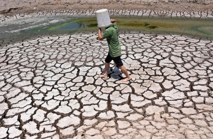
Farming households dip below 1m for first time in 2023
![[Graphic News] More Koreans say they plan long-distance trips this year](http://res.heraldm.com/phpwas/restmb_idxmake.php?idx=644&simg=/content/image/2024/04/17/20240417050828_0.gif&u=)
![[KH Explains] Hyundai's full hybrid edge to pay off amid slow transition to pure EVs](http://res.heraldm.com/phpwas/restmb_idxmake.php?idx=644&simg=/content/image/2024/04/18/20240418050645_0.jpg&u=20240419100350)


As the rainy season comes to an end, the country is expected to face sweltering weather throughout the week, according to the Korea Meteorological Administration on Sunday.
The North Pacific high-pressure system developed north, placing the Korean peninsula on its outer edges, bringing about a heat wave and partly cloudy skies in place of wet weather.
Temperatures will remain at hotter than 30 degrees Celsius for most of the nation, with the mercury in Seoul rising as high as 33 degrees Celsius on Monday.
Although not as high as the rest of the country, coastal regions will see daily highs just below 30 degrees Celsius, giving eager beach goers a lot of incentive to flood the coasts as vacation season gets in full swing.
Scattered showers are still expected to hit the nation till Wednesday, mainly in North and South Gyeongsang Province, and parts of Gangwon Province.
This year’s rainy season, or jangma, started noticeably early, with June’s total rainfall reaching a record 404 millimeters, and July’s rainfall likely to fall short of previous years, at 423 millimeters as of Sunday.
Last summer, the country was drenched by total average rainfall of 1,508 millimeters.
The Category 4 Typhoon Ma-on, which was expected to hit South Korea, is now largely forecast to only affect Japan.
Typhoons are expected to threaten the Korean Peninsula till September with a total of four expected to hit the country this year.
Typhoons travel along the edge of high-pressure systems, making Korea a likely destination during August and September.
Kim Tae-ryong, head of the KMA’s National Typhoon Center, also predicts that a super typhoon will hit the nation this year, possibly causing massive damage.
By Robert Lee (robert@heraldcorp.com)


![[KH Explains] Hyundai's full hybrid edge to pay off amid slow transition to pure EVs](http://res.heraldm.com/phpwas/restmb_idxmake.php?idx=652&simg=/content/image/2024/04/18/20240418050645_0.jpg&u=20240419100350)

![[Today’s K-pop] Illit drops debut single remix](http://res.heraldm.com/phpwas/restmb_idxmake.php?idx=642&simg=/content/image/2024/04/19/20240419050612_0.jpg&u=)