
Most Popular
-
1
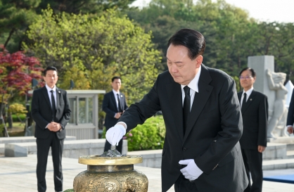
Yoon's approval rating plunges to all-time low
-
2
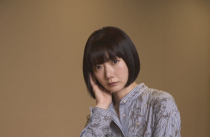
Bae Doo-na shares portraying Korean identity in Hollywood's 'Rebel Moon'
-
3
S. Korea votes in favor of Palestinian bid for UN membership

-
4
[From the Scene] Monks, Buddhists hail return of remains of Buddhas
![[From the Scene] Monks, Buddhists hail return of remains of Buddhas](//res.heraldm.com/phpwas/restmb_idxmake.php?idx=644&simg=/content/image/2024/04/19/20240419050617_0.jpg&u=20240419175937)
-
5
Medical schools granted enrollment quota flexibility for next year


![[From the Scene] Monks, Buddhists hail return of remains of Buddhas](http://res.heraldm.com/phpwas/restmb_idxmake.php?idx=644&simg=/content/image/2024/04/19/20240419050617_0.jpg&u=20240419175937)

-
6
Yoon offers first one-on-one meeting with opposition leader next week

-
7
France rejects opening Paris flight routes to T'way Air, deals blow to Korean Air merger
-
8
Chinese man behind drug scam targeting teens nabbed in Cambodia

-
9
[Graphic News] French bulldog most popular breed in US, Maltese most popular in Korea
![[Graphic News] French bulldog most popular breed in US, Maltese most popular in Korea](//res.heraldm.com/phpwas/restmb_idxmake.php?idx=644&simg=/content/image/2024/04/18/20240418050864_0.gif&u=)
-
10
Iran fires air defense batteries in provinces as sound of explosions heard near Isfahan


![[Graphic News] French bulldog most popular breed in US, Maltese most popular in Korea](http://res.heraldm.com/phpwas/restmb_idxmake.php?idx=644&simg=/content/image/2024/04/18/20240418050864_0.gif&u=)


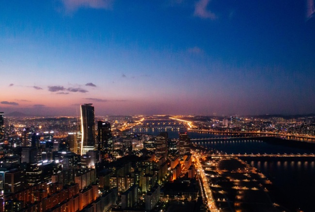
The past and future of Seoul as seen through its river islands
By 홍성진Published : Dec. 26, 2014 - 17:33
It is not easy for the citizens of Seoul today to imagine the idyllic landscapes that once existed in the city. In particular, the city’s main waterway, the Hangang River, had over ten scenic islets, up until as late as the 1960s, as well as wide open beaches that stretched along both sides of the river. During the winter, the river remained frozen for many weeks, providing the citizens with a vast space for winter recreational and sporting activities, such as skating and sledding, while in summer, it offered the many groups of women and children plenty of spaces for laundry, bathing, and swimming. Going back further in time to when Seoul was the capital of the Joseon Dynasty (1392-1910), the river attracted royals and aristocrats with its exciting vantage points, where they set up pavilions and enjoyed the scenic and picturesque spots along the river.
The natural, long-term processes of erosion and sedimentation taking place in and around the Hangang River have continuously created new islets and reclaimed old ones. Many of these islets became part of the riverside beaches during the dry season and then returned to islets when the river’s water level rose during the rainy season. Of these islands scattered along the length of the Hangang, the larger ones included Dangjeongseom (Misariseom), Seokdo (Muhakdo), Jamsildo (Jamsilseom), Ttukseom, Jeojado, Yuldo (Bamseom), Yeouido, and Nanjido. There have also been small islands noted for their particular beauty, such as Burido, Banpodo (Seoraeseom), Nodeulseom (Jungjido), and Baengmado.
It was during the late 1960s, when most of these river islands began to disappear, that the Korean government implemented a policy for the reclamation and management of public waters. The efforts to develop the Hangang River culminated in the 1980s, when Seoul was chosen to be the host city of the 1988 Olympic Games. Such development gradually removed the picturesque scenery created by the white sandy beaches and islets dotting the river.
The development plan brought significant changes to the landscape of the Hangang River, sometimes creating new islands. One of such island is Seonyudo, currently standing south of Jeoldusan Mountain in Hapjeong-dong. The islet had originally been home to the tallest (40 meters) riverside hill, called Seonyubong, whose scenic beauty had been widely regarded as a jewel of the Yanghwajin area, as shown by a landscape painting titled Seonyubong Peak, by Jeong Seon (a.k.a. Gyeomjae, 1676-1759), one of the great landscape painters of the late Joseon period. As it had been used as a source of aggregate for the construction of Yeouido Airfield and several river embankments, the hilltop was shaved off by degrees until it became flat, as it appears today.
The river islands that survived the turbulent period of intense industrial development have recently been transformed into landmarks of Seoul and popular tourist attractions.
Yeouido, the crown jewel of the islands of the Hangang River
As the largest of all the islands in the Hangang River, cutting across the capital of Korea, Yeouido has become the center of Korean politics, finance, journalism, and culture. Today it has a floating population of 500,000 people and is home to the National Assembly building, the headquarters of Korea’s top three broadcasting networks (i.e. KBS, MBC, and SBS), the Korea Stock Exchange, IFC Seoul, and the main offices of some of Korea’s leading business institutions.
It would likely be difficult for many to imagine that, in the 1960s, Yeouido was significantly different than it is today. Back then, the island was represented by a historical horse ranch and a huge airfield that was built in the early 20th century, when Korea was under Japanese colonial rule. Up until then, it had been a seemingly useless piece of sandy land whose shape was often changed by the flow of the Hangang River.
It was in 1967 that Seoul Mayor Kim Hyeon-ok, better known by his nickname the “Bulldozer Mayor,” decided to fully implement his comprehensive Hangang River Development Plan, choosing Yeouido as the starting point. There soon appeared a 7.6-kilometer-long embankment, built with stone, earth, and sand, enclosing the island, which was followed by extensive reclamation work. The work ended 110 days later with the creation of a clearly outlined island with a new shape.
The creation of the new island was followed by the construction of the National Assembly building and more large buildings to house broadcasting and stock exchange companies and banks. Today, the island has become one of Korea’s leading business districts, with over 30,000 residents and about 7,000 offices that create a floating population of about 500,000 people.
The 1960s development plan turned Yeouido into one of the first metropolitan sub-centers of Seoul, sharing the functions traditionally performed by the city center in the Gwanghwamun and Jongno districts. The newly created island also resulted in the appearance of a large open area at its very center. This public space was originally called “May 16th Square (Oillyuk Gwangjang),” but was soon renamed “Yeouido Square”. After a three-year remodeling project, it was turned into a public park in 1999, and is now divided into four areas designed under the themes of traditional Korean wood, a lawn, traditional performing arts, and ecology.
Many citizens of Seoul today believe that Yeouido Park is comparable to Central Park in New York or Hyde Park in London. The area was covered with black asphalt for 27 years, but has now been reborn as a green park with cool water, lush grass, and beautiful trees. Today, Yeouido is not only a center of Korean politics, finance, media, and culture but also one of Seoul’s greener areas, attracting citizens of all ages for rest and various recreational activities.
Nanjido, a fundamental change from a dump to a garden
If you need to choose just one spot in Seoul that best represents the dramatic change the city has undergone throughout its contemporary history, Nanjido should be one of the strongest candidates. The current name of the island literally means “isle of orchids and spiritual mushrooms,” although its earlier name, Jungchodo, means “isle full of flowers”. The island was once a dreamy honeymoon destination and one of the most popular dating places among the young citizens of Seoul.
To their surprise and dismay, the beautiful river island was abruptly designated a dumping ground in 1978. The Korean government decided that the islet, which at that time was located on the distant outskirts of Seoul, was an ideal site for the disposal of waste produced by the new apartment complexes in Jamsil, Sanggye-dong, and Gui-dong. As a result, Nanjido lost its scenic beauty almost instantly and, in the 1980s, became an ugly sight, with bulldozers handling huge heaps of trash.
In 1992, Nanjido’s capacity as a landfill site was reached, with 92 million tons of trash having been piled up on it for 14 years, turning it into a massive 90-meter-tall tableland. By then, it was often depicted as a “hell” created by the incredibly rapid growth of the Korean capital, filled with foul smells that caused headaches and nausea and toxic and inflammable materials that often caught fire.
The 2002 FIFA World Cup Korea-Japan served as a turning point in the destiny of Nanjido. As Seoul was designated as one of the host cities of the World Cup, government policy makers decided to build a new World Cup stadium around the former river island and turn it into a complex of eco-friendly parks: Peace Park, Haneul Park, Noeul Park, and Nanjicheon Park. These parks now attract large numbers of Seoul citizens and are covered with alang-alang grass blossoms in spring and silky, feathery plumes of pampas grass in fall. Today, these parks are widely regarded as an ecological jewel, where over 1,000 species of animals and plants prosper, giving visitors an overwhelming feeling of wonder and admiration for the mystery of life.
Ttukseom, from a royal hunting ground to a resting place for modern citizens
Ttukseom in the Joseon Period (1392-1910) had been a hunting ground used exclusively by Joseon rulers, and hence, the entry of ordinary people was strictly prohibited. However, after the end of the Pacific War (1941-1945), the area was occupied by groups of poor people searching for shelter and land to farm. In the 1950s and 1960s, the riverside area became one of the most loved destinations for the citizens of Seoul seeking relaxation and recreation, particularly during the summer holiday season. With the poor public transportation network at the time, the citizens of Seoul preferred the nearby white sandy beaches of Ttukseom to any of the seaside resorts outside the capital.
However, the Hangang River Development Project, launched in the 1960s, turned the Ttukseom area into an industrial zone packed with factories. And in the 1980s, those factories were pushed back from the riverside island by the construction of a racecourse, golf course, and other recreational facilities, which came to be quite popular.
In 2005, the administration of Seoul launched a project to recover the island’s natural and ecological heritage via the creation of Seoul Forest. The project has recently been completed, resulting in an ecological park combined with multi-purpose cultural facilities and consisting of the Culture and Art Park, Ecology Forest, Hands-on Nature Learning Center, Wetlands Ecological Field, and Hangang Waterside Park. Currently, Seoul Forest occupies most of the former royal hunting ground, an area five times larger than Yeouido.
Sebitseom, the future of Seoul’s river islands
The Sebitseom Islets, located near the southern end of Banpo Bridge, are significantly different from the other islands of the Hangang River introduced above, in that they are, above all else, wholly man-made structures. These “islands” are regarded as special, because they represent the aesthetic sensibility of the citizens of Seoul as well as their pride in the river and aspiration toward a comfortable and culturally rewarding lifestyle.
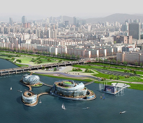
Today, known as the largest man-made island, Sebitseom was originally planned to be constructed through a Build-Transfer-Operate (BTO) scenario, and was completed in 2011 after a two-year construction project. The project went through many twists and turns, including repairing and rebuilding, until it was finally opened to the public in October 2014.
The name of the islets, Sebit (“three lights”), refers to the three primary colors—red, green and blue—which symbolize Seoul’s desire for the harmony of all its citizens and to shine brightly as the capital of Korea. Gabitseom, the largest of the three, houses a convention center, while the other two are home to an exhibition hall, water sports facility, and theater restaurants.
These artificial islands feature a unique structure that is characterized by the use of underwater wires attaching the three islets together, allowing them to float on the river. The unique beauty of the islets has attracted worldwide attention, and led them to be chosen as a filming location for a blockbuster movie, Avengers 2.
Known as the largest of its kind in the world, the Sebitseom Islets are now listed among the top tourist attractions in Seoul. While there are similar structures in Hanover and Rostock, in Germany, and in Graz, in Austria, these three man-made islets surpass them in terms of size and facilities. From the design that connects the three structures to a huge water screen, the islets are equipped with attractive features that are expected to contribute to the effort to turn Seoul into one of the world’s major tourist destinations.
By online news team(onlinenews@heraldcorp.com)
![[From the Scene] Monks, Buddhists hail return of remains of Buddhas](http://res.heraldm.com/phpwas/restmb_idxmake.php?idx=652&simg=/content/image/2024/04/19/20240419050617_0.jpg&u=20240419175937)
![[KH Explains] Hyundai's full hybrid edge to pay off amid slow transition to pure EVs](http://res.heraldm.com/phpwas/restmb_idxmake.php?idx=652&simg=/content/image/2024/04/18/20240418050645_0.jpg&u=20240419100350)
![[Today’s K-pop] Illit drops debut single remix](http://res.heraldm.com/phpwas/restmb_idxmake.php?idx=642&simg=/content/image/2024/04/19/20240419050612_0.jpg&u=)